


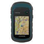

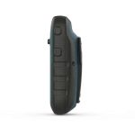
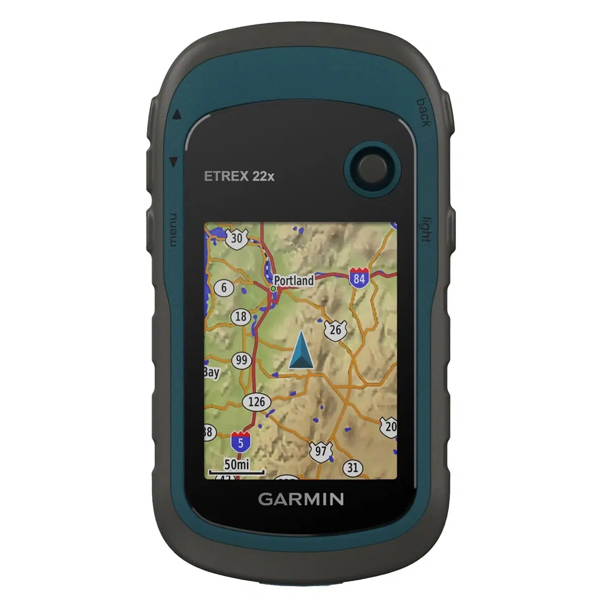
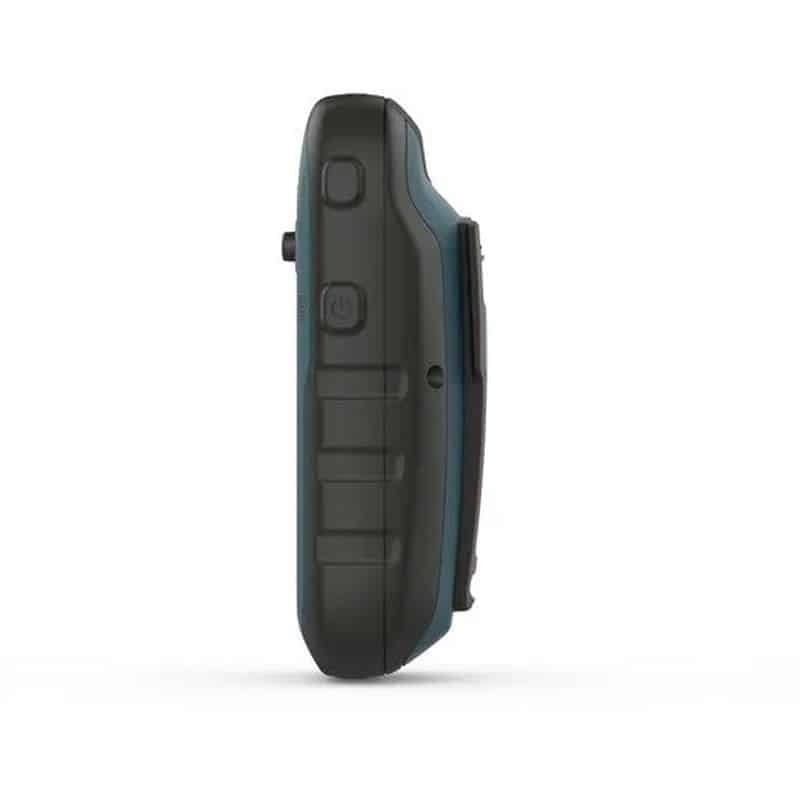
Garmin eTrex® 22x Handheld GPS
Original price was: R5,095.00.R4,895.00Current price is: R4,895.00.
Outdoor handheld GPS.
 From only R628.51 pm over 12 months with FinChoicePay.
Find out how...
Make that purchase possible with FinChoicePay.
FinChoicePay is a new payment method that allows you to buy now and pay back your purchase over 3 to 12 months.
4 easy steps to use FinChoicePay
Browse your online stores and proceed to check-out
Choose FinChoicePay as payment method
Choose to repay over 3 to 12 months
Create your account and complete your purchase
Here's what you'll need:

A valid email address

To be over 18 years old
Still want more information on FinChoicePay? Click here...
![]() Pay over 3 EQUAL zero-interest
instalments of R1,631.67 with PayJustNow.
Pay over 3 EQUAL zero-interest
instalments of R1,631.67 with PayJustNow.
Find out how...
PayJustNow is a simple, easy-to-use payment system.
Here’s how it works:
PayJustNow allows you to pay for your purchase over 3 equal, zero interest instalments. You’ll pay one instalment at the time of purchase, the next at the beginning of the following month and the last one a month thereafter.
#zerointerest

Step 1:
Browse your favourite online stores and proceed to check-out.

Step 2:
Choose PayJustNow as your payment method.

Step 3:
Create your account as easily as if your eyes were shut (though we’d recommend you keep them open).

Step 4:
Complete your purchase and whoop for joy!
Here’s what you’ll need:
 A valid RSA ID document
To be over 18 years old
An email address
A SA Bank issued debit or credit card

Description
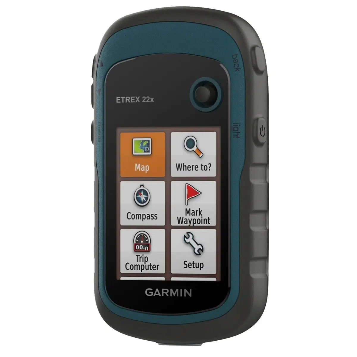
The eTrex 22x offers durability and affordability that the eTrex handheld GPS series is known for — along with preloaded TopoActive Africa maps. These devices are perfect for quad bikes, bicycles, boats or hiking.
Main Features:
- 2.2” sunlight-readable colour display with 240 x 320 display pixels for improved readability
- Preloaded with TopoActive Africa maps with routable roads and trails for cycling and hiking
- Support for GPS and GLONASS satellite systems allows for tracking in more challenging environments than GPS alone
- 8 GB of internal memory for map downloads plus a microSD™ card slot
- eTrex 32x adds a 3-axis compass and barometric altimeter
- Battery life: up to 25 hours in GPS mode with 2 AA batteries
| Display Size | 3.5 x 4.4 cm; 2.2″ diag (5.6 cm) |
| Battery type | 2 AA batteries (not included); NiMH or Lithium recommended |
| Display Resolution | 240 x 320 pixels |
| GPS | Yes |
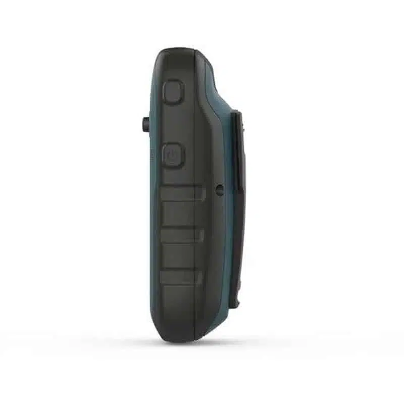
| Dimension | 5.4 x 10.3 x 3.3 cm |
| Interface | mini USB |
| Waterproof | IPX7 |
| Weight | 141.7 g (with batteries) |
| Display Type | 2.2″ transflective, 65K colour TFT |
| Battery life | 25 hours |
| High-sensitivity receiver | Yes |
Maps & Navigation
| Storage and Power Capacity | microSD™ card (not included) |
| Waypoints/favourites/locations | 2000 |
| Preloaded maps | Yes (TopoActive Africa; routable) |
| Basemap | Yes |
| Navigation Routes | 200 |
| Navigation Track Log | 10,000 points, 200 saved tracks |
| Memory/history | 8GB |
| Ability to add maps | Yes (via microSD card) |
Features
| Send route selection to MapShare during trip | No |
| Satellite Imagery | no |
| Send waypoints to MapShare during trip | No |
| Active Weather | No |
| Contacts | No |
| Rinex logging | No |
| inReach remote widget | No |
| Compatible with Garmin Connect™ Mobile | No |
| Touchscreen | No |
| LED beacon flashlight | No |
| inReach remote compatible | No |
| Sun and moon information | Yes |
| Virtual keyboard for custom messaging | No |
| MapShare compatible with tracking | No |
| Geocaching-friendly | Yes (paperless) |
| Send and receive text messages to other inReach device | No |
| GLONASS | Yes |
| Send and receive text messages to SMS and email | No |
| Frequency band | No |
| Displays national, state and local parks, forests, and wilderness areas | Yes |
| Smart notifications on handheld | No |
| Connect IQ™ (downloadable watch faces, data fields, widgets and apps) | No |
| Custom maps compatible | yes (100 custom map tiles) |
| Compatible with Earthmate | No |
| LiveTrack | No |
| Exchange locations with other inReach device | No |
| Vibration alert | No |
| Map segments | 3000 |
| Point-to-point navigation | Yes |
| Picture viewer | Yes |
| Barometric altimeter | No |
| Weather forecasts | No |
| XERO™ Locations | No |
| Interactive SOS | No |
| VOX (voice activation) | No |
| Automatic routing (turn by turn routing on roads) for outdoor activities | Yes |
| GPS compass (while moving) | Yes |
| Includes detailed hydrographic features (coastlines, lake/river shorelines, wetlands and perennial and seasonal streams) | Yes |
| Includes searchable points of interests (parks, campgrounds, scenic lookouts and picnic sites) | Yes |
| FISH FORECAST | Yes |
| Compass | No |
| Lens material | acrylic |
| Compatible with Garmin Explore™ app | No |
| Tracks | 200 |
| Galileo | No |
| Garmin Explore website compatible | No |
| Area calculation | Yes |
| MIL-STD-810 | No |
| Location reporting (send and receive GPS positions) | No |
| VIRB® camera remote | No |
Related Products