


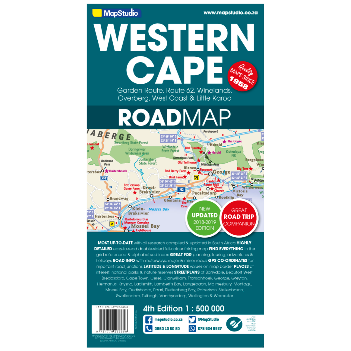
Map Studio Western Cape 4th Edition
Low Stock
Paper map

Low Stock
Paper map
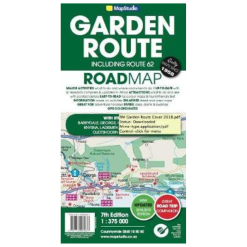
Explore the Western Cape Province with this detailed road map, featuring essential information for travelers, adventurers, and wine enthusiasts.
Features:
Specifications:
Coverage includes: Garden Route & Route 62, South Western Cape, Winelands and Overberg, West Coast Flower Region, and Little Karoo
Small detailed street plans: Cape Town CBD, Montagu, Barrydale, Ladismith, Oudtshoorn, Mossel Bay, Knysna, Plettenberg Bay, Humansdorp, George, Stellenbosch, Franschhoek, Paarl, Wellington, Hermanus, Swellendam, Robertson, Ceres, Tulbagh, Langebaan, and Beaufort West
Detailed road map at a scale of 1:500,000
| Cookie | Duration | Description |
|---|---|---|
| cookielawinfo-checkbox-analytics | 11 months | This cookie is set by GDPR Cookie Consent plugin. The cookie is used to store the user consent for the cookies in the category "Analytics". |
| cookielawinfo-checkbox-functional | 11 months | The cookie is set by GDPR cookie consent to record the user consent for the cookies in the category "Functional". |
| cookielawinfo-checkbox-necessary | 11 months | This cookie is set by GDPR Cookie Consent plugin. The cookies is used to store the user consent for the cookies in the category "Necessary". |
| cookielawinfo-checkbox-others | 11 months | This cookie is set by GDPR Cookie Consent plugin. The cookie is used to store the user consent for the cookies in the category "Other. |
| cookielawinfo-checkbox-performance | 11 months | This cookie is set by GDPR Cookie Consent plugin. The cookie is used to store the user consent for the cookies in the category "Performance". |
| viewed_cookie_policy | 11 months | The cookie is set by the GDPR Cookie Consent plugin and is used to store whether or not user has consented to the use of cookies. It does not store any personal data. |