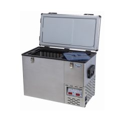
 National Luna Legacy Smart 50 Stainless Steel Fridge/Freezer Bluetooth
 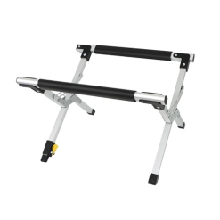 LeisureQuip Portable Fridge Stand with Level
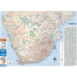
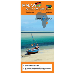
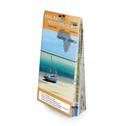
  Tracks 4 Africa Southern & Eastern Africa Paper Map 1st Edition


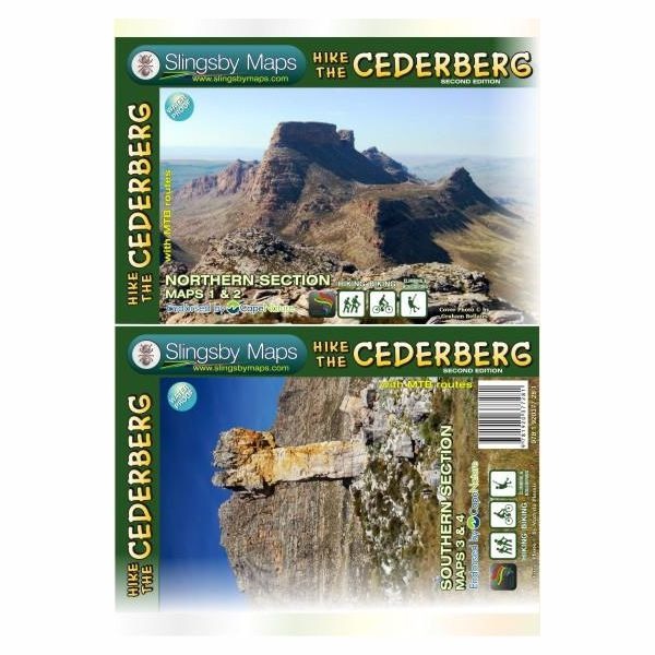
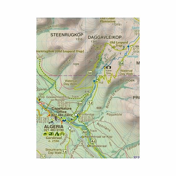
Slingsby Map Hike The Cederberg 2
R375.00
SLINGSBY MAP HIKE THE CEDERBERG 2 [2MAPS]
 Pay over 3 EQUAL zero-interest
instalments of R125.00 with PayJustNow.
Pay over 3 EQUAL zero-interest
instalments of R125.00 with PayJustNow.
Find out how...

HOW IT WORKS
PayJustNow allows you to pay for your purchase over 3 payments with 0% interest and no fees. Pay a third at checkout and you get your goods as if you have paid in full. The remaining two instalments are debited on your specified instalment date.

Browse online or in-store and proceed to check-out

Choose PayJustNow as your payment method
Create your account and get an instant approval decision
Complete your transaction
WHAT YOU WILL NEED
BE OVER 18
YEARS OLD
BE AN SA
RESIDENT
HAVE A DEBIT OR
CREDIT CARD
HAVE A VALID
EMAIL ADDRESS
0% INTEREST. 3 PAYMENTS. NO STRESS.
WHY PAY ANY OTHER WAY?
Description
The Slingsby Hike The Cederberg #2 is a set of two maps.
Features:
Two double-sided A!-sized maps
Covers entire Cederberg Wilderness and extending north to Wolfdrif and south to Mount Ceder.
Printed on Duraflex waterproof material
Packaged together in a folding slipcase
Maps detail popular bouldering sites, biking trails, caves, perennial water, pools, rock formations, best places to stay, and much more.
Specifications:
A1+ x 2 full colour, double sided maps
Scale: 1:40 000 (2.5cm = 1km)
20m Contours, relief shading
ISBN: 978-1-920377-28-1